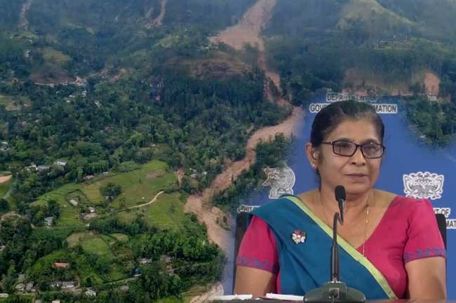
Authorities have identified approximately 4,800 landslides across Sri Lanka using satellite imagery and data analysis conducted in the aftermath of Cyclone Dithwa, the Arthur C. Clark Centre’s Director‑General Kumari Migahakotuwa said.
Speaking at a media briefing today (12), Migahakotuwa said that the satellite images and geospatial data collected after the storm were analysed to produce a comprehensive landslide map.
The analysis revealed that the number of landslide occurrences is far greater than previously reported by media and field observations. The mapping exercise covered the entire country, uncovering thousands of slope failures that were not visible or documented earlier.
“By using satellite imagery, we were able to detect even smaller slope failures and areas that would otherwise be missed in conventional reporting,” Migahakotuwa said, noting that some events occurred within dense forest areas.
According to the analysis, the majority of identified landslides occurred in central highland regions, but the dataset represents nationwide occurrences linked to the cyclone’s impact.
Experts say that comprehensive geospatial analysis is critical in understanding the full scale of disaster impacts, which may greatly exceed early estimates based solely on ground reports.